Take your bike past all the beautiful beaches Sanday has to offer.
If you want to pack in as many miles as possible between ferries, then this is probably the way to do it. There’s not much of Sanday left unseen on this route.
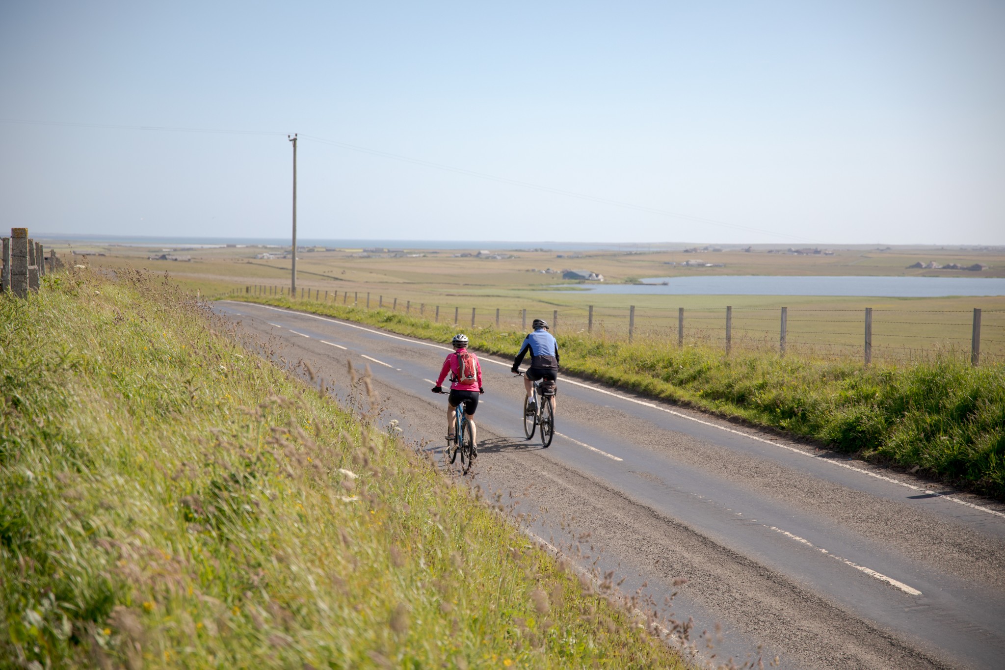
While the island may be relatively flat, that flatness does come at the expense of shelter. Remember to look at forecasted wind speeds before deciding whether it’s within your limits. The good news is there are lots of obvious options to cut out various sections if you start questioning your fitness. But do remember that in the summertime the cycle back to the ferry from the centre of the island will very likely be against a headwind.
Starting from the ferry terminal follow the obvious road north. As you reach the top of the short brae, you’ll have a fine view to your right across the Bay of Stove. After 1.5km you’ll see the distinctive chimney and now derelict Victorian farm buildings of Stove, a classic ‘Model Farm’ of the 19th century.
A further 4km brings you to a short, steep pull up the brae of Warsetter. From here you travel along a flattish broad ridge – the only real high part of the island – with views west across to Eday and Westray beyond. Then, as you near Backaskaill, you’ll get an impressive view across the flat lands of Sanday and its many sweeping bays.
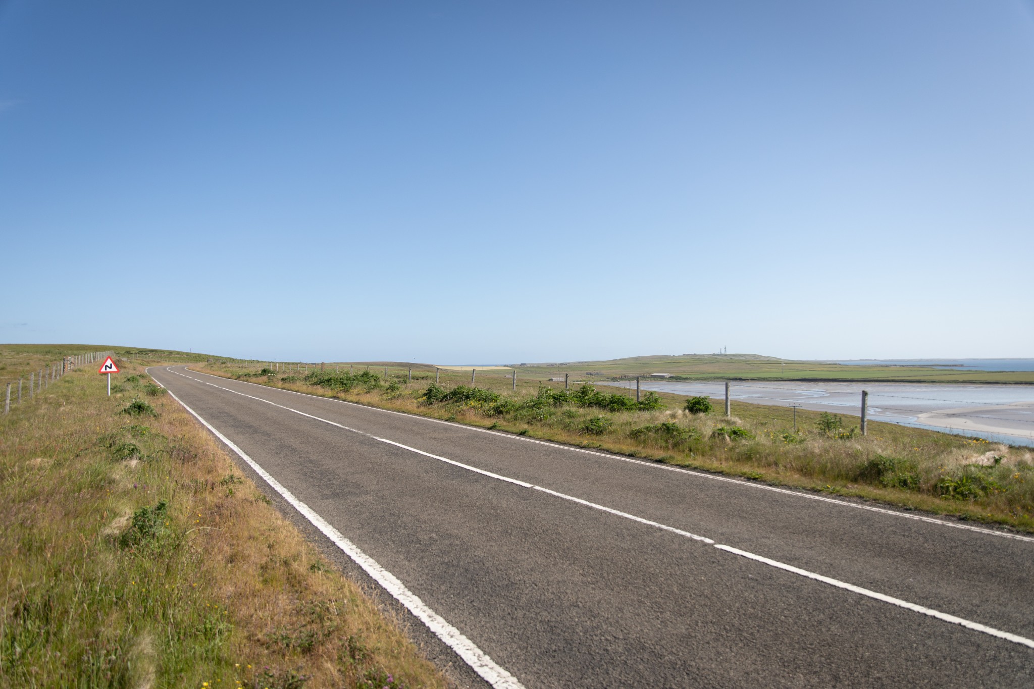
After passing high above Backaskaill Bay and then the Bea Loch down to your right, the main road takes a sharp turn to the right. Turn left here onto a minor road which takes you past the campsite at Ayres Rock and briefly along the island’s west coast. After around 2km and a couple of bends you’ll come to a T-junction with the B9068, the main road running north to Burness.
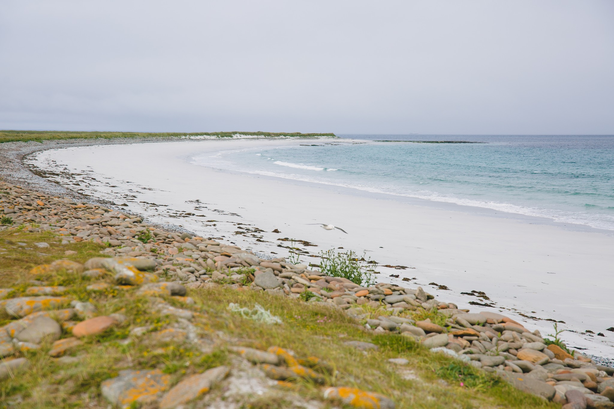
Turn left here and follow the road north. After about 3.5km turn right at the sign for Whitemill Bay. After 400m follow the next sign pointing left and head north for the last 2.5km to reach the bay, one of Sanday’s finest beaches. Our Whitemill Bay walking route is the perfect opportunity to explore this area further.
Return the way you came for about 6km until you see a road to your left signposted Lady Village. After 2km turn left to pass through the village itself. There’s a well-stocked community shop here and don’t forget to visit the excellent Heritage Centre and Croft House Museum.
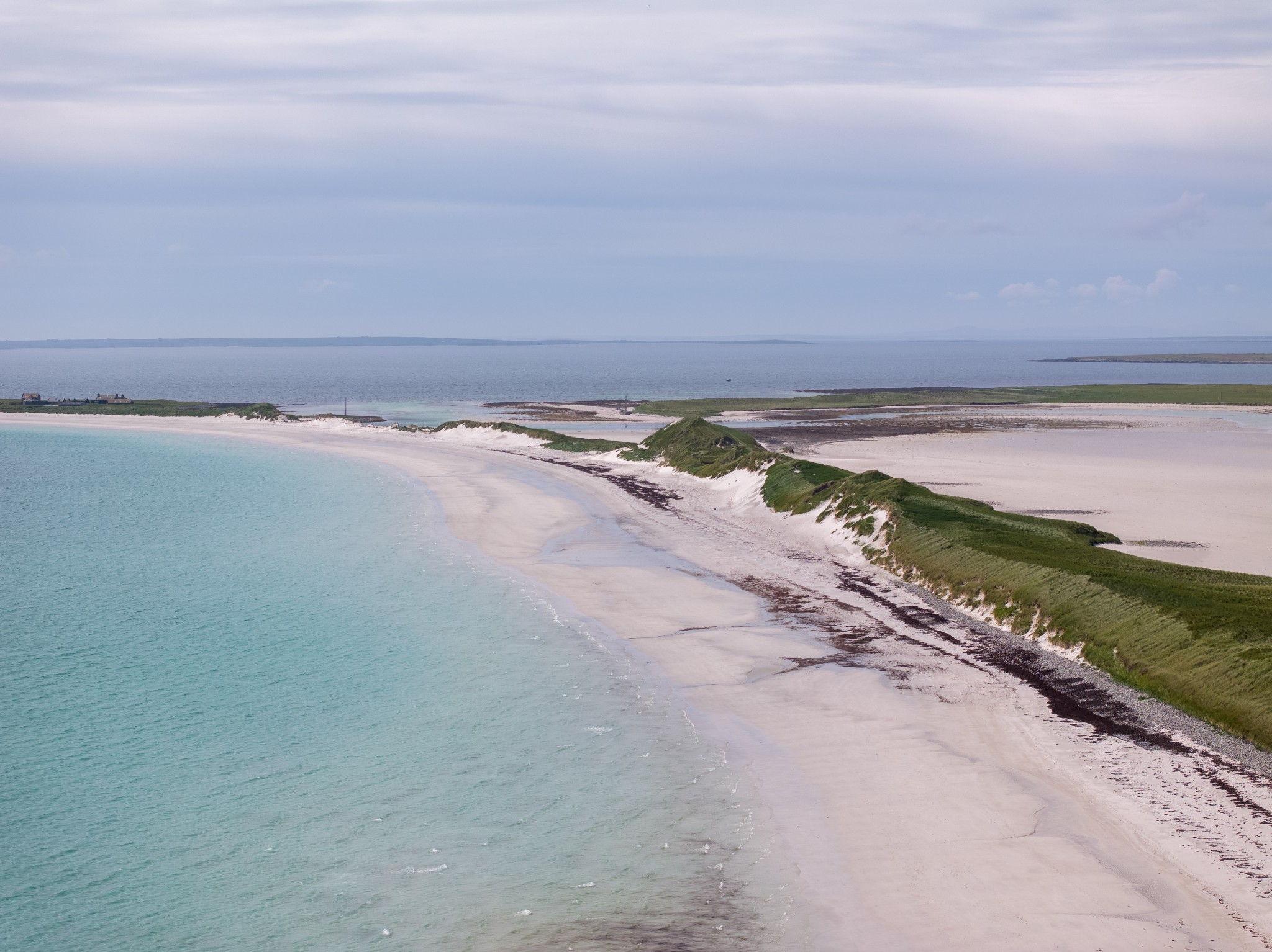
Carry on through the village in a generally easterly direction. After 1.5km you’ll pass the tidal sand flats of Cata Sand. You can either carry on following the route northeast across the Plain of Fidge or, if you want to cut out the section around the north of the island, you can stop here and instead walk out to visit the famous sand dunes that separate Cata Sand from Bay of Newark to the east.
If you decide to stay in the saddle then carry on a further 2km to pass the large farm of Newark. After that the road skirts the fabulous Bay of Lopness to your right, though you won’t see it for the sand dunes. Around 2km past Newark you’ll spot a track or two which will take you the very short distance to get a view across the bay.
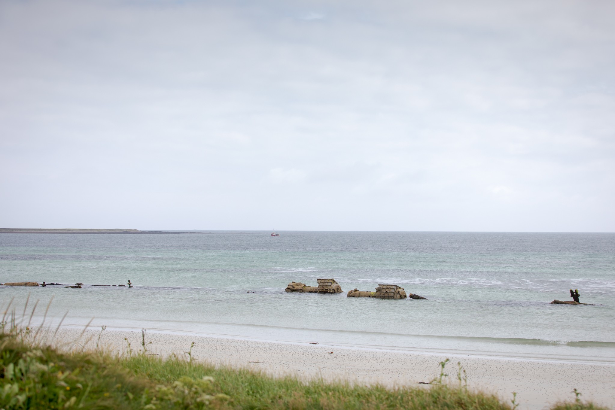
After a further 2km you’ll see a sign on the right for the Bay of Lopness WW1 wreck. This is the wreck of the German destroyer B98, a ship which fought at the Battle of Jutland in 1916. It was driven ashore in 1920 while under tow from Scapa Flow to Rosyth. Much of the wreck can still be seen at low water.
Carry on east along the road before it takes a sharp turn to the left to head north through the settlement of Lettan and around the North Loch. The road carries on along the coast to Sandquoy before rising over a low hill. On a good day you might just make out Fair Isle on the horizon to the northeast from here.
When you arrive at a T-junction, turn right to head back the way you came to the village at Lady. After Lady Village carry straight on and follow the road for around 3km, passing the Little Sea and the head of Kettletoft Bay (also in the area is our Elsness & Quoyness Chambered Cairn walking route, which is well worth a visit). At the T-junction turn left to head 1km to Kettletoft Village. There are two public houses here, both of which offer food – but do check in advance about opening times and availability.
Head back up the road going north, this time staying straight ahead for around 2.5km until you reach a junction on the left at the well-stocked Sinclair’s Stores shop. Take this road to head uphill for around 1km. Follow the road left and retrace the start of your route to travel the final 8km or so back to the ferry terminal at Loth.
- Plan your trip to Sanday
Daily ferries connect Sanday and Kirkwall. View timetables and book online via the Orkney Ferries website. Booking in advance is recommended, and bikes can be carried for free.
You can also fly to the island with Loganair's inter-isles service. Visit the Loganair website to view the current timetable.
The Sanday Bus offers on-demand transport across the island and a ferry connection service. There are two public toilets available in Sanday – one at the island's ferry terminal at Loth, and another at the pier in Kettletoft.
Find out more about Sanday on the island's Explore page, or visit the official island website.
- Food & drink
There are two pubs in the village of Kettletoft that offer food and drink, the Kettletoft Hotel and The Belsair. Do check opening times in advance if you're planning on stopping past for refreshments.
The popular 59 Degrees North Pizzeria is found to the north west of the island and offers excellent pizzas and more.
There are also two well-stocked shops in Sanday, the Sanday Community Shop in Lady village, and Sinclair's General Stores close to the island's school.
This cycle route information was funded through the North Isles Landscape Partnership Scheme by the National Lottery Heritage Fund.